Photogrammetry & GIS Services for Accurate Geospatial Mapping Solutions
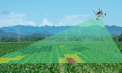
Welcome to the forefront of precision mapping. At Stesalit Inc., our photogrammetry services are the cornerstone of spatial accuracy and digital innovation. Leveraging cutting-edge AI and machine learning technologies, we offer unparalleled digital data extraction from aerial and satellite imagery.
Through innovative AI/ML based aerial digital data capturing solutions, Stesalit Inc. extracts accurate digital vector data from a host of sources, such as Aerial Photography, and Satellite Imagery. We offer a complete range of photogrammetric services for Topographic Mapping, Utilities Mapping, Road and Highway Planning, Cadastral Mapping, City Modeling, etc. Our services include consulting, project planning, software application development, image processing, data conversion and integration.
Stesalit Inc. has had extensive success in photogrammetric project planning and execution. We develop and use AI/ML based training models to extract data from the Satellite and Aerial Imagery. Our team is committed to develop and invest in emerging technologies, keeping up to date with advances in Mapping solutions and services at all times. Our services can be customized for project specific requirements, and we also execute large scale projects as contractors, from inception to completion.
Our Services Include:
- Topographic Mapping: Create detailed elevation models and terrain maps with high accuracy.
- Utilities Mapping: Efficiently map and manage utility assets across vast areas.
- Road Planning: Plan and design road networks using accurate, real-world data.
- Cadastral Mapping: Establish clear land titles with precise boundary delineation.
- City Modeling: Develop detailed 3D city models for urban planning and development.
Tailored Solutions for Every Project: Each project carries unique challenges and requirements. At Stesalit, we customize our solutions to meet your specific needs, ensuring that your project from inception to completion is handled with the utmost precision and expertise.
Investing in Technology for Tomorrow: Our commitment to staying at the technological forefront means continuously evolving our processes and investing in the latest mapping solutions. Whether it’s managing large-scale mapping projects or providing intricate detail for small areas, our team is equipped to deliver excellence.
Start Your Project with Stesalit: Let us help you capture the world with accuracy and detail. Contact us today to see how our photogrammetry services can be tailored to your project’s needs.
Photogrammetry Services